How ToF Technology Enables High-Precision 3D Mapping with UAVs
How Does ToF Technology Help UAVs Achieve High-Precision 3D Mapping?
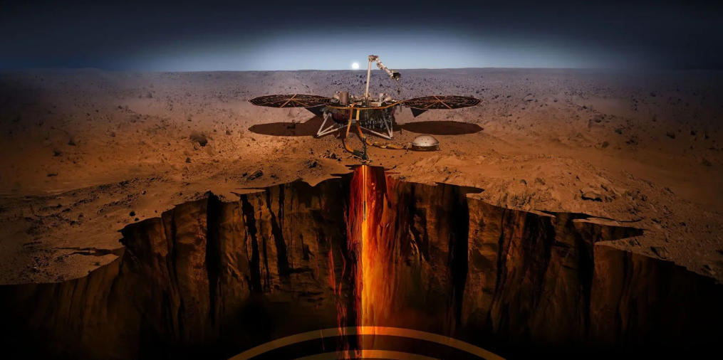
With the rapid advancement of unmanned aerial vehicles (UAVs) and high-resolution 3D sensing technologies, TOF (Time-of-Flight) depth sensing has emerged as a critical tool in modern geological surveys, cave mapping, and mineral exploration. In extreme and inaccessible environments—such as the Naica Crystal Cave in Chihuahua, Mexico—ToF technology enables precise three-dimensional data acquisition that traditional surveying methods cannot reliably achieve.
By integrating ToF depth cameras with UAV platforms, researchers can safely capture accurate 3D spatial data in harsh geological settings, supporting scientific research, environmental protection, and digital preservation.
What Is Time-of-Flight (ToF) Technology?
Time-of-Flight (ToF) technology is a high-precision distance measurement method that calculates depth by measuring the time required for emitted light or laser pulses to travel to an object and return to the sensor. In essence, a ToF sensor functions as a fast, optical rangefinder capable of capturing dense 3D depth maps and point cloud data in real time.
Compared with traditional stereo vision systems or bulky LiDAR scanners, ToF technology offers several important advantages for UAV-based surveying:
-
Real-time 3D perception: Depth measurements are completed within milliseconds, enabling dynamic mapping during flight
-
High ranging accuracy: Millimeter-level precision captures fine geological structures and surface details
-
Lighting robustness: Reliable performance in low-light, high-contrast, or enclosed environments such as caves and tunnels
-
Compact and lightweight design: Ideal for UAV payload constraints and flexible deployment
These characteristics make ToF depth cameras particularly suitable for aerial cave exploration, underground mapping, and complex terrain analysis.

UAV-Based Cave Mapping with ToF Depth Sensors
High-Precision 3D Mapping in Extreme Cave Environments
Equipping UAVs with ToF cameras allows researchers to conduct non-contact, high-precision 3D scanning of deep caves and confined geological spaces. In environments like the Naica Crystal Caves or large tunnel systems such as the Cascade Tunnel, manual surveying is often unsafe, time-consuming, or technically infeasible.
ToF-enabled UAVs can rapidly capture dense point cloud data, generating accurate 3D cave models for:
-
Geological and mineralogical research
-
Structural stability analysis
-
Conservation planning and access control
-
Virtual exploration and scientific visualization
ToF Technology in Geospatial Surveying and Terrain Analysis
When combined with datasets from organizations such as the U.S. Geological Survey (USGS) and platforms like USGS EarthExplorer, ToF-based UAV mapping enables the creation of high-accuracy Digital Terrain Models (DTMs) and Digital Elevation Models (DEMs).
Applications include:
-
Updating coastal and inland terrain data along regions such as the Gulf of Mexico
-
Supporting mineral resource surveys and geological fault analysis
-
Enhancing topographic mapping in remote or inaccessible areas
Compared with conventional surveying methods, ToF-based 3D mapping delivers higher spatial resolution while significantly reducing fieldwork time.
Scientific Research and Mineral Exploration Applications
Mapping the Naica Crystal Cave
The Naica Giant Crystal Cave is globally renowned for its massive selenite crystals and extreme internal conditions, with temperatures exceeding 58 °C and near-saturation humidity. These conditions make traditional measurement tools impractical.
Using UAVs equipped with ToF depth sensors, researchers can:
-
Accurately measure crystal dimensions, volume, and spatial distribution
-
Capture detailed cave geometry for mineral growth analysis
-
Create precise 3D digital twins for long-term monitoring
These datasets support mineralogical studies while also contributing to conservation strategies and safe tourism planning.
Urban, Industrial, and Infrastructure Surveying
Beyond natural cave environments, ToF technology is widely applied in:
-
Tunnel inspection and deformation monitoring
-
Bridge and industrial structure assessment
-
Mining tunnel modeling and safety evaluation
In large-scale infrastructure projects—such as railway tunnels or underground mining systems—ToF-based UAV surveys enable rapid generation of accurate 3D tunnel models to support engineering design and risk analysis.

Education, Museums, and Digital Outreach
High-resolution 3D models generated using ToF technology can be visualized in museums, research institutions, and educational platforms. Geological wonders such as the Naica Crystal Cave or Mexican quartz caves can be transformed into:
-
Interactive virtual tours
-
Immersive educational experiences
-
Digital archives for long-term preservation
This approach makes complex geological structures accessible to the public without disturbing fragile environments.
Why ToF Outperforms Traditional Geological Surveying Methods
Traditional cave and geological surveys rely on manual tools such as total stations, handheld rangefinders, or static topographic maps. These methods suffer from several limitations:
-
Labor-intensive and slow data collection
-
High safety risks in confined or high-temperature environments
-
Accumulated measurement errors in complex geometries
By contrast, ToF depth cameras provide:
-
Rapid large-area scanning when mounted on UAVs
-
High-density, millimeter-accurate point clouds
-
Real-time 3D reconstruction, reducing post-processing effort
-
Reliable operation in harsh environments, including caves, mines, and tunnels
ToF data can also be seamlessly integrated with GIS, GPS, and global coordinate systems, including references such as the Prime Meridian (Zero Meridian, London), enabling precise geolocation and global data consistency.
Case Study: ToF-Enabled UAV Mapping in the Naica Crystal Caves
In the Cave of Crystals in Naica, Chihuahua, Mexico, UAVs equipped with ToF sensors have demonstrated the ability to:
-
Perform rapid full-cave 3D scanning using pre-planned flight paths
-
Generate panoramic spatial maps for intuitive visualization
-
Precisely analyze crystal morphology and spatial arrangement
-
Build digital twin models for scientific research and monitoring
These ToF-generated point cloud datasets enable accurate calculation of crystal volume, cave layout analysis, and investigation of mineral formation processes—providing essential data for both research and conservation.

Applications of ToF Technology in U.S. Geological Surveys
Across the United States, ToF technology is increasingly used in geological surveys and environmental monitoring under frameworks such as USGS Explorer and ASPRS standards.
High-Accuracy Terrain Modeling
UAV-mounted ToF cameras enable rapid scanning of mountains, canyons, and complex landscapes, supporting:
-
Topographic updates for coastal regions
-
Urban digital twin development
-
Infrastructure planning and environmental assessment
Flood Risk and Environmental Monitoring
By capturing accurate surface elevation data, ToF technology supports:
-
Flood simulation and risk assessment
-
Watershed and coastal monitoring
-
Early-warning systems for natural disasters
Mineral Resource Analysis
In mineral exploration, ToF-based point cloud data enables detailed analysis of ore body geometry, cave structures, and spatial mineral distribution—supporting both extraction planning and conservation strategies.
Future Development Trends
As UAV platforms evolve and events such as the Commercial UAV Expo continue to drive innovation, ToF technology is expected to expand further into:
-
Fully autonomous cave and tunnel exploration
-
Real-time 3D map generation during flight
-
High-precision mineral monitoring using AI-driven point cloud analysis
The integration of ToF sensors, plenoptic cameras, and advanced 3D reconstruction algorithms will continue to push the boundaries of geological surveying, while supporting the preservation of iconic sites such as the Naica Crystal Caves and other fragile geological environments.
Conclusion
Time-of-Flight technology is transforming UAV-based geological surveying by delivering accurate, efficient, and scalable 3D mapping solutions. From cave exploration and mineral research to environmental monitoring and digital preservation, ToF-enabled UAV systems provide unparalleled insight into complex geological spaces—bridging the gap between inaccessible physical environments and high-precision digital understanding.
Vzense DS86 & DS87 ToF 3D Cameras - Industrial Grade, High Precision,5m1600*1200

After-sales Service: Our professional technical support team specializes in TOF camera technology and is always ready to assist you. If you encounter any issues during the usage of your product after purchase or have any questions about TOF technology, feel free to contact us at any time. We are committed to providing high-quality after-sales service to ensure a smooth and worry-free user experience, allowing you to feel confident and satisfied both with your purchase and during product use.


Please upload banner from store admin blog pages