Best LiDAR for Drones: How to Choose the Right UAV LiDAR Sensor
What Is the Best LiDAR for Drones and How Do You Choose a UAV LiDAR Sensor?
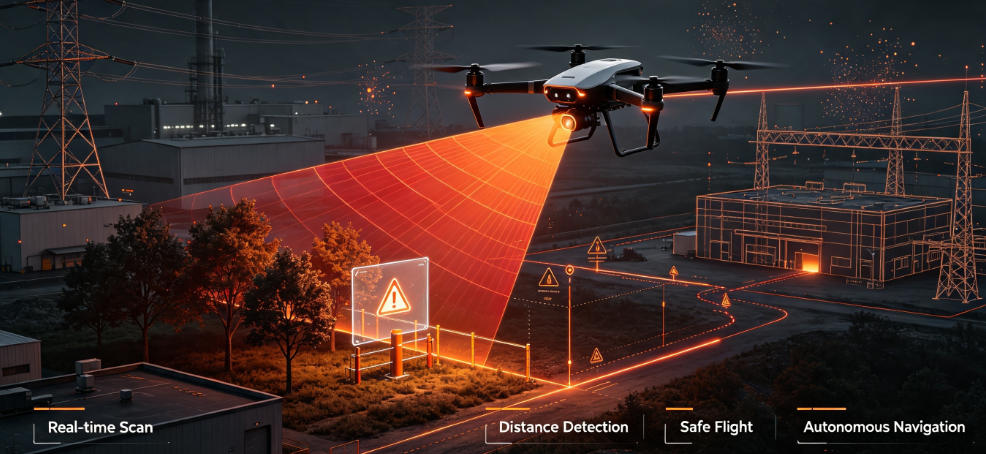
With the rapid development of drones (UAVs), autonomous aerial vehicles, intelligent mapping, and robotics technology, Lidar for drones has become an essential technology for enhancing drone perception capabilities. Compared with traditional cameras and GPS positioning systems, LiDAR sensors for UAVs use laser ranging technology to obtain highly accurate 3D spatial information. Even in low-light, nighttime, or complex environments, LiDAR helps drones achieve precise navigation, obstacle avoidance, mapping, and environmental perception.
What are the best lidar sensors for drones and UAVs?
This article will provide a detailed overview of how to choose the right LiDAR based on drone application requirements, LiDAR technology characteristics, and different sensor types. It will also introduce high-performance LiDAR solutions suitable for drones, robots, and industrial applications.
What Is Drone LiDAR? Why Do Drones Need LiDAR Sensors?
Drone LiDAR (Light Detection and Ranging for drones) is a 3D sensing technology installed on UAV platforms. It works by emitting laser pulses and measuring the time it takes for the reflected light to return (Time of Flight, ToF) to calculate the distance between the drone and surrounding objects, generating highly accurate 3D point cloud data.
Traditional drones mainly rely on:
- GPS positioning
- RGB cameras
- Ultrasonic sensors
- IMU (Inertial Measurement Unit) navigation
However, these technologies have certain limitations:
- Cameras are easily affected by lighting conditions;
- GPS accuracy decreases in indoor environments, forests, and urban canyons;
- Ultrasonic sensors have limited detection range.
In contrast, LiDAR sensors for drones can provide centimeter-level or even millimeter-level distance measurement capabilities, enabling:
- High-precision 3D mapping
- Autonomous navigation
- Obstacle avoidance
- SLAM positioning
- Terrain mapping
- Industrial inspection
Therefore, LiDAR has become one of the key sensing technologies driving the intelligent development of modern drones.

Best LiDAR for Drones: What Factors Should You Consider When Choosing a UAV LiDAR Sensor?
Choosing the best Lidar for drones is not only about focusing on a single specification, such as maximum detection range. A comprehensive evaluation of sensor performance, drone payload limitations, and application requirements is necessary.
Different applications require different LiDAR characteristics. For example:
- Drone obstacle avoidance focuses more on real-time response speed;
- Mapping drones require higher point cloud accuracy;
- Industrial inspection drones need a balance between detection range, reliability, and environmental adaptability.
When selecting a UAV LiDAR sensor, the following key factors should be carefully considered:
1. LiDAR Detection Range
Drones often operate at high speeds and need to detect surrounding environments and potential obstacles in advance. Therefore, LiDAR range is one of the most important performance factors.
A longer detection range allows drones to better predict obstacles, optimize flight paths, and improve autonomous navigation safety.
Based on different application requirements, drone LiDAR systems can generally be divided into the following categories:
Short-Range LiDAR: 0.1m–5m
Suitable for:
- Close-range drone obstacle avoidance
- Indoor flight
- Robot navigation
- Automatic hovering assistance
Short-range LiDAR sensors usually feature compact size and low power consumption, making them ideal for small drones and consumer-grade UAV applications.
Medium-Range LiDAR: 5m–50m
Suitable for:
- Industrial drones
- Logistics robots
- Autonomous inspection equipment
This type of LiDAR provides stable distance detection in more complex environments and supports autonomous flight, navigation, and path planning.
**Long-Range LiDAR: 100m+
**
Mainly used for:
- Drone surveying
- Terrain scanning
- Forest monitoring
- Power line inspection
- Large-scale 3D modeling
Long-range LiDAR enables drones to capture environmental information across wider areas, improving mapping efficiency and data accuracy.
Therefore, when selecting the best LiDAR sensors for drones, it is important to choose the appropriate detection range based on flight altitude, mission distance, and operating environment rather than simply pursuing the longest possible range.
2. Weight and Power Consumption
One of the biggest limitations of drones is payload capacity and flight endurance. Therefore, an excellent UAV LiDAR sensor must achieve a balance between performance, weight, and energy consumption.
Compared with ground robots or fixed devices, drone-mounted LiDAR systems usually require:
- Compact design
- Lightweight structure
- Low power consumption
- Efficient data output capability
Lightweight LiDAR reduces the payload burden on drones, improves flight stability, and extends operating time.
For example, solid-state LiDAR eliminates complex mechanical rotating structures, offering significant advantages in:
- Size reduction
- Reliability improvement
- Lower power consumption
Because of these advantages, solid-state LiDAR is becoming increasingly popular for drones and mobile robot applications.
In addition, low-power LiDAR helps reduce overall drone energy consumption, allowing UAVs to perform longer missions such as:
- Autonomous inspection
- Aerial surveying
- Environmental monitoring
3. Point Cloud Density and Measurement Accuracy
For drone applications that require detailed spatial modeling, such as Drone Mapping, LiDAR Surveying, Digital Twin development, and Building Information Modeling (BIM), point cloud quality is a critical factor affecting final results.
High-performance drone LiDAR systems typically require:
- High sampling rate
- High point cloud density
- High measurement accuracy
- Stable data output performance
- Strong environmental adaptability
High-density point clouds can more accurately reconstruct real-world environments, including:
- Building structures
- Road surfaces
- Vegetation height
- Industrial equipment layouts
For drone surveying projects, higher-quality point cloud data enables:
- More accurate 3D maps
- Better digital twin models
- More efficient data analysis
At the same time, in challenging environments such as forests, mountains, and urban areas, LiDAR systems need strong anti-interference capabilities to ensure drones continuously obtain reliable 3D spatial information.
Recommended Types of LiDAR Sensors for Drones
1. ToF LiDAR Sensor (Time of Flight LiDAR)
Time of Flight LiDAR is one of the most widely used distance sensing technologies in drones, robotics, and autonomous vehicles. Its working principle is based on measuring the time difference between laser emission and return. The LiDAR sensor sends laser pulses toward an object, and when the laser reflects back, the system calculates the distance to the target based on the travel time, obtaining accurate depth information.
ToF LiDAR offers advantages such as fast distance measurement, short response time, high accuracy, and strong real-time performance, making it highly suitable for drone applications that require rapid environmental perception. Compared with some advanced scanning LiDAR solutions, ToF LiDAR is more cost-effective and features a more compact structure, making it ideal for integration into small drones and intelligent robots.
Main applications include:
- UAV Obstacle Avoidance: Detect obstacles in real time and improve drone flight safety;
- Robot Navigation: Provide accurate distance data for path planning and autonomous movement;
- Autonomous Drone Systems: Combined with AI algorithms and SLAM technology to achieve autonomous positioning, navigation, and environmental understanding.

2. 3D LiDAR Sensor
A 3D LiDAR Sensor generates high-accuracy three-dimensional point cloud data by scanning the surrounding environment, enabling drones to achieve advanced spatial perception and 3D modeling capabilities. Compared with traditional distance sensors, 3D LiDAR can not only measure object distances but also reconstruct environmental structures, making it widely used in drone surveying, smart agriculture, and infrastructure inspection.
In the field of Drone Mapping, LiDAR can quickly scan complex environments such as mountains, forests, buildings, and roads to generate accurate 3D maps and terrain models, improving surveying efficiency and data accuracy.
In Smart Agriculture applications, drones equipped with LiDAR can analyze crop height, monitor plant growth conditions, and create digital farm models, providing valuable data support for automated agricultural management.
For Power Line Inspection, LiDAR helps drones measure the distance between transmission lines and surrounding objects, analyze tower structures, and evaluate power line safety conditions. This significantly improves inspection efficiency while reducing the risks associated with manual inspections.
With the continuous development of drone technology, ToF LiDAR, 3D LiDAR, and AI vision fusion solutions are becoming key sensing technologies for next-generation intelligent drones, providing more reliable 3D environmental data for autonomous flight, precision mapping, and industrial automation.
Which LiDAR Sensors Are Best for Drones and UAVs?
Currently, drone LiDAR solutions on the market are mainly divided into two major categories: Lightweight Solid-State LiDAR and Industrial LiDAR Sensors. Different types of LiDAR are suitable for different drone applications and should be selected based on the flight platform, mission requirements, and operating environment.
1. Lightweight Solid-State LiDAR
Solid-State LiDAR uses a design without mechanical rotating components. Compared with traditional mechanical LiDAR systems, it offers a more compact, stable, and reliable solution, making it highly suitable for drones where weight and power consumption are critical factors.
By eliminating moving mechanical parts, solid-state LiDAR provides several advantages, including:
- Compact size
- Lightweight design
- Strong vibration resistance
- High reliability
- Real-time environmental sensing capability
Lightweight solid-state LiDAR is mainly suitable for:
- Small UAVs: Meets lightweight design requirements and improves flight endurance;
- Consumer Drones: Used for intelligent obstacle avoidance, distance measurement, and autonomous flight assistance;
- Autonomous Navigation Devices: Combined with SLAM and AI algorithms for autonomous positioning and path planning.
For drone applications requiring fast response, low power consumption, and compact integration, lightweight solid-state LiDAR is currently one of the ideal choices.
2. Industrial LiDAR Sensor
Industrial LiDAR Sensors are designed for professional applications requiring high accuracy, high reliability, and long-term operation. They typically provide longer detection ranges, higher measurement accuracy, and stronger environmental adaptability.
Compared with consumer-grade LiDAR solutions, industrial LiDAR systems can maintain stable performance in challenging outdoor environments, extended operation periods, and demanding industrial tasks.
Industrial LiDAR is mainly used in:
- Industrial Drones: Equipment inspection, factory monitoring, and complex environment detection;
- Smart City Mapping: Building detailed 3D city models through UAV-based LiDAR scanning;
- Infrastructure Inspection: Inspection and maintenance of bridges, roads, power lines, and large structures.
For drone projects that require high-precision measurement, long-range scanning, and reliable long-term operation, industrial LiDAR sensors provide more dependable 3D environmental perception capabilities.
LiDAR for Drones vs Camera: Why Do Drones Choose LiDAR?
| Comparison | Camera | LiDAR |
|---|---|---|
| Impact of Lighting Conditions | High | Low |
| Night Operation | Limited | Excellent |
| Distance Measurement | Requires algorithm estimation | Direct measurement |
| 3D Modeling | Requires software processing | Native point cloud generation |
| Environmental Perception | Relies on visual information | Provides high-precision spatial data |
Therefore, for high-reliability drone applications such as:
- Autonomous drones
- Industrial inspection drones
- Surveying and mapping drones
- Intelligent robots
LiDAR is often a more reliable sensing solution.
Ultra small compact waterproof laser ranging LW20 100 meters Pixhawk compatible

Conclusion: What Is the Best LiDAR for Drones?
Choosing the best Lidar for drones depends on the specific application requirements:
- Small drone obstacle avoidance → Choose lightweight ToF LiDAR Sensors
- Industrial drone inspection → Choose reliable Industrial LiDAR Sensors
- Drone mapping and surveying → Choose high-precision 3D LiDAR Sensors
- AI-powered drones → Choose a LiDAR + Camera fusion solution
In the future, with the continuous development of technologies such as UAV LiDAR sensors, 3D LiDAR mapping, AI vision, and SLAM navigation, LiDAR will play an increasingly important role in autonomous drone flight, smart manufacturing, smart cities, and robotics applications.




Please upload banner from store admin blog pages