
Servo Robotics Guide: LW20 LiDAR Principle & Development Solutions
How Does Servo Robotics Work with LW20 LiDAR for UAV & Robot Obstacle Avoidance?
I. What Is Servo Robotics? In-Depth Fundamental Knowledge
Servo Robotics refers to servo robot technology, a niche field of perception-motion fusion within embedded robot development. Its core component is the servo motor. Unlike ordinary electric motors, servo motors integrate closed-loop angle control circuits, which lock rotational angles precisely via PWM pulse signals. This forms the core foundation for Servo Robotics to realize environmental scanning at low cost.
The complete technical system consists of two core modules: servo motion control module and environmental sensing acquisition module.
raditional industrial robots rely on multi-axis robotic arms paired with costly multi-line LiDAR to achieve 3D perception, often costing thousands of yuan. In contrast, Servo Robotics adopts a lightweight DIY development concept. A single miniature servo motor carries a single-point ranging sensor. Program-controlled reciprocating swing of the servo combines single-point ranging data with real-time angle information to stitch a 2D fan-shaped environmental contour. This drastically lowers development barriers for robots with autonomous obstacle avoidance and terrain detection functions, making it the mainstream solution for university robotics training, compact UAVs, and inspection robots.
1. Operating Logic of Servo Motors in Servo Robotics
Servo motors distinguish angles through PWM signals ranging from 1ms to 2ms: a 1000μs pulse corresponds to the minimum rotation angle, 2000μs corresponds to the maximum rotation angle, and the midpoint 1500μs marks the neutral position. When the Servo Robotics system runs, the main controller continuously outputs variable PWM signals to drive the servo to swing left and right at a constant speed. Meanwhile, it synchronously reads ranging values from the sensor, pairing each set of angle + distance data one-to-one.
Basic logic example: When the servo rotates to 30°, the LiDAR detects an obstacle 20 meters ahead; at 90°, the ranging result shows no obstruction within 50 meters. The program aggregates all data points to map obstacle distribution in the forward field of view, delivering simplified laser scanning that replaces expensive 360° rotating LiDAR.
2. Three Main Application Scenarios of Servo Robotics
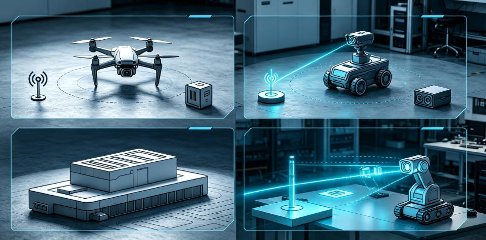
(1) Airborne Servo Perception Systems (UAV Industry)
This is the most commercially mature application of Servo Robotics, widely deployed in plant protection UAVs, mapping UAVs, and inspection UAVs.
Core Advantages:
- Fixed downward LiDAR only measures vertical height directly below, while servo scanning covers a forward fan-shaped area to detect obstacles such as trees, utility poles, and steep slopes in advance.
- When paired with dual-echo LiDAR, the system can simultaneously identify treetops and true ground elevation to enable precise terrain following.
- The total assembly weight is only around 20g, creating minimal impact on the battery life of compact UAVs.
Typical Projects: Terrain following for plant protection UAVs, forward obstacle avoidance for FPV drones, elevation calibration for mapping UAVs.
(2) Ground Autonomous Mobile Robots
Autonomous inspection vehicles, educational competition robots, and warehouse AGVs represent the second major application field for Servo Robotics.
Core Advantages:
- Eliminates the need for pricey 360° rotating LiDAR, drastically lowering entry-level development costs.
- Horizontally swinging servo gantries cooperate with path-planning algorithms to enable autonomous obstacle avoidance and detour navigation.
- Waterproof sensors are available for outdoor deployment, adapting to rainy, dusty and other harsh environments.
Typical Projects: Campus inspection robots, autonomous warehouse transport vehicles, obstacle-avoidance robots for university electronic design competitions.
(3) Fixed-Point Monitoring Servo Scanning Equipment
Servo Robotics solutions are also widely adopted in industrial and environmental monitoring sectors.
Core Advantages:
- Vertically mounted servo gantries drive LiDAR to swing up and down, covering a broad elevation range.
- 100-meter long-range LiDAR enables non-contact remote monitoring, eliminating the need for on-site personnel to access hazardous zones.
- Supports connection to IoT platforms for real-time remote data viewing.
Typical Projects: Mine slope deformation monitoring, remote river water level measurement, silo material level detection.

II. Core Technical Challenges in Servo Robotics Development
Most developers encounter three common issues when building servo scanning systems: data distortion, scanning lag, and inaccurate ranging. These problems stem from compatibility defects between servo hardware and sensing sensors:
-
Gantry Vibration Degrades Ranging Accuracy
High-speed reciprocating swing of servo motors generates minor jitter. Flimsy sensor mounting structures cause laser beam offset, leading to erratic distance readings. Select lightweight sensors to reduce servo load and suppress vibration interference.
-
Asynchronous Timing of Data Acquisition
A time lag exists between servo angle updates and LiDAR data reading, causing mismatched angle-distance pairs and distorted obstacle outlines. Two solutions: adopt high-refresh-rate LiDAR, or synchronize servo movement and sensor sampling in main controller programs.
-
Limitations for Outdoor Deployment
Conventional compact ranging modules lack water and dust resistance, risking damage when exposed to open air. Sensors with narrow temperature tolerance produce large ranging errors under extreme hot or cold conditions, restricting outdoor use of Servo Robotics devices.
-
Poor Communication Compatibility
Many ranging sensors only support a single serial port, making simultaneous connection to flight controllers and servo mainboards cumbersome and raising overall development complexity.
III. Servo Robotics Sensor Selection Comparison: Adaptation Differences of Ranging Sensors
-
8m Short-Range ToF LiDAR
Only suitable for indoor educational miniature robot Servo projects. Short detection range and no waterproof rating prevent deployment on outdoor UAVs and inspection vehicles; severe ranging failure occurs at long distances.
-
360° Rotating LiDAR
Boasts omnidirectional scanning, yet suffers heavy weight, high power consumption, and exorbitant costs. Mounting these units on compact UAVs drastically shortens flight time. Poor shock resistance leads to high failure rates in complex outdoor environments, making them unsuitable for lightweight Servo Robotics development.
-
LW20 100m Waterproof LiDAR
Balances lightweight design, long detection range, outdoor protection, and multi-platform compatibility. It covers all Servo Robotics development scenarios including indoor teaching, outdoor UAVs, and ground inspection vehicles, striking an optimal balance between development cost and equipment performance as a cost-effective option for servo scanning systems.
IV. Four Core Development Challenges of Servo Robotics & Corresponding Solutions
Developers frequently face distorted data, scanning stuttering, and unreliable ranging when building servo scanning systems, all rooted in misalignment between servo motion and sensor sampling.
Challenge 1: Gantry Vibration Causes Fluctuating Ranging Data
Problem Description: Mechanical vibration generated during high-speed servo swing shifts the LiDAR laser beam, creating erratic distance values and warped obstacle outlines.
Solutions:
- Prioritize lightweight sensors to reduce servo load and inertial vibration.
- Adopt rigid mounting structures for the gantry, avoiding flexible brackets.
- Implement sliding mean filtering or Kalman filtering in software to smooth volatile data.
- Reduce servo swing speed to minimize impact from start-stop motion.
Challenge 2: Desynchronized Timing Between Angle and Distance Data
Problem Description: Time offset between servo angle output and LiDAR sampling misaligns angle-distance pairs, leading to misplaced obstacles in scanning results.
Solutions:
- Deploy LiDAR with refresh rates above 100Hz to shorten sampling intervals.
- Trigger servo movement and sensor data reading simultaneously in program logic to align timing sequences.
- Read sensor data via interrupts to avoid delays from main loop operations.
Challenge 3: Insufficient Environmental Adaptability for Outdoor Scenarios
Problem Description: Standard compact ranging modules lack water and dust resistance and easily break when deployed outdoors; sensors with narrow operating temperature windows produce large ranging deviations in extreme climates.
Solutions:
- Select sensors with IP65 or higher ingress protection to resolve waterproofing at the hardware level.
- Choose wide-temperature sensors (-30℃ to +50℃) for year-round outdoor operation.
- Install simple sun and rain shields to extend service life if necessary.
Challenge 4: Limited Cross-Platform Communication Compatibility
Problem Description: Many ranging sensors only support a single communication interface, complicating wiring when connecting to both flight controllers and servo mainboards.
Solutions:
- Prefer sensors with dual Serial and I2C communication interfaces.
- Prioritize hardware natively compatible with Pixhawk, Arduino, Raspberry Pi and other mainstream development platforms.
- Select sensors with complete debugging tools to reduce workload for low-level driver development.

V. Adaptation Advantages of LW20 LiDAR in Servo Robotics
Among all available ranging sensors, the ultra-compact waterproof LW20 LiDAR stands out as a highly compatible option for Servo Robotics projects thanks to its hardware specifications.
1. Ultra-Light 10g Body Reduces Servo Load
The LW20 weighs only 10g excluding cables. When paired with an SG90 miniature servo to form a scanning gantry, the total assembly weight stays under 20g. This drastically cuts inertial vibration during servo swing and greatly improves data stability, a critical lightweight advantage for load-sensitive miniature UAVs.
2. 100-Meter Maximum Range + Dual Echo Output Optimizes Terrain Following
Conventional short-range LiDAR (8–12m) only meets indoor vehicle demands and cannot support long-distance forward obstacle avoidance for UAVs. The LW20 delivers a maximum detection range of 100 meters and supports dual first/last echo signal output:
- First echo: Detects proximal obstacles such as treetops and overhead power lines.
- Last echo: Penetrates vegetation gaps to measure true ground elevation.
This feature enables Servo Robotics terrain-following systems to accurately distinguish vegetation canopy from ground, drastically lowering collision risks for plant protection UAVs.
3. IP67 Waterproof & Wide-Temperature Design Expands Outdoor Use Cases
The LW20 carries an IP67 ingress protection rating, resisting rain splash and dust accumulation, with an operating temperature range of -30℃ to +50℃. Servo Robotics systems for outdoor inspection vehicles and field mapping UAVs eliminate the need for custom waterproof enclosures, simplifying mechanical design.
4. Dual Communication Interfaces Compatible with Mainstream Development Platforms
Equipped with both Serial and I2C communication protocols, the LW20 offers native compatibility with Pixhawk flight controllers, while Arduino and Raspberry Pi developers can implement direct wiring without adapters. A maximum data refresh rate of 388Hz perfectly matches high-speed servo scanning to maintain synchronized data acquisition.
Ultra small compact waterproof laser ranging LW20 100 meters Pixhawk compatible

VI. Conclusion: Development Prospects of Servo Robotics
As a low-cost, highly flexible robot perception solution, Servo Robotics is evolving from hobbyist DIY projects toward commercial mass deployment. Advances in miniature servo precision and falling LiDAR costs will continuously narrow the performance gap between servo scanning systems and professional rotating LiDAR, while its cost advantage will continue to expand.
Whether for university robotics education, UAV industrial applications, or industrial monitoring equipment development, Servo Robotics delivers a technical path to "maximize perception capabilities with minimal hardware investment." Mastering the core logic of Servo Robotics equips developers with a low-cost gateway to autonomous robot perception systems.




Please upload banner from store admin blog pages