
DJI Livox Avia LiDAR Explained TOF LiDAR for Mapping & SLAM
What Is DJI Livox Avia LiDAR and How Does TOF LiDAR Improve Mapping, SLAM, and Smart City Applications?
In today’s era of intelligent sensing and rapid 3D spatial digitalization, TOF LiDAR (Time of Flight LiDAR) technology has become a core sensing solution for UAV mapping, autonomous driving, smart cities, and industrial inspection. Among them, the DJI Livox Avia LiDAR stands out as a representative solid-state LiDAR product, thanks to its high precision, long-range detection capability, and lightweight design.
This article provides a comprehensive analysis of its technical principles, performance, and real-world applications.
1. What Is TOF LiDAR? Why Has It Become a Mainstream Ranging Technology?
TOF (Time of Flight) LiDAR is a 3D sensing technology based on optical time-of-flight measurement principles. Its core working mechanism is:
Measuring the time difference between laser emission and its reflection from a target, then calculating distance using the speed of light, and generating 3D point cloud data.
In simple terms, TOF LiDAR determines how far an object is based on 'how long light travels,' enabling accurate spatial perception and 3D modeling.

Core Advantages of TOF LiDAR
Compared with traditional ultrasonic, stereo vision, or structured light systems, TOF LiDAR performs more reliably in industrial and outdoor environments. Its key advantages include:
-
High-precision ranging (centimeter-level or even millimeter-level)
Suitable for industrial measurement, UAV mapping, and robotics navigation -
Strong resistance to ambient light interference
Stable performance under strong sunlight, backlight, and complex outdoor conditions -
Long-range detection capability
Covers short-range obstacle avoidance to hundreds-of-meters detection for power inspection and aerial surveying -
High-density 3D point cloud generation (3D Point Cloud)
Enables high-precision Digital Twin modeling and 3D mapping -
Real-time performance for dynamic environments
Widely used in SLAM-based real-time mapping and autonomous navigation
2. DJI Livox Avia LiDAR Core Specifications and Technical Advantages
As an important industrial LiDAR product in the DJI ecosystem, the Livox Avia LiDAR adopts an advanced solid-state scanning architecture and TOF ranging technology. It demonstrates outstanding performance in long-range detection, dense point cloud output, and environmental adaptability, making it widely used in UAV mapping, smart city modeling, and industrial inspection.
1. Ultra-Long Detection Range (Up to 450m)
Under low-light or complex outdoor conditions, the Livox Avia achieves a detection range of up to 450 meters, allowing stable identification of distant targets.
Applications include:
- UAV LiDAR mapping (UAV LiDAR Mapping)
- Power line and transmission tower inspection (Power Line Inspection)
- Large-scale forestry and terrain scanning (Forestry LiDAR Surveying)
- Large infrastructure and engineering monitoring
In power inspection scenarios, it can accurately detect transmission lines, insulators, and tower structures, significantly reducing manual high-altitude inspection risks while improving efficiency and safety.
2. High-Density Point Cloud (240,000 points/s)
The Livox Avia supports up to 240,000 points per second output and incorporates multi-echo technology (Dual-echo / Triple-echo LiDAR), significantly improving performance in complex environments.
Key advantages include:
- Enhanced vegetation penetration, enabling ground terrain reconstruction beneath forest canopies
- High-precision 3D reconstruction, improving DEM/DSM quality
- Improved SLAM performance for robotics localization and mapping
- Strong adaptability to mixed urban and forest environments
In forestry mapping, multi-echo capability helps distinguish leaves, branches, and ground surfaces, enabling highly accurate terrain reconstruction.
3. 2cm-Level High Precision Ranging
Under typical operating conditions, the Livox Avia achieves ±2cm ranging accuracy, meeting industrial-grade measurement requirements.
Applications include:
- Smart City Digital Twin modeling
- Building Information Modeling (BIM)
- Industrial structural measurement and deformation monitoring
- HD map generation for autonomous driving
Its high precision ensures clear building edges and geometric consistency in urban-scale 3D modeling, improving digital twin reliability.
4. Dual Scanning Modes: Non-Repetitive and Repetitive
The Livox Avia supports flexible scanning modes depending on application needs.
Non-repetitive scanning
Provides wider coverage, suitable for fast environmental perception and dynamic mapping
Repetitive scanning
Offers more stable data structure, suitable for precise modeling and long-term monitoring
Technical benefits:
- Improved point cloud coverage and uniformity
- Compatibility with mainstream SLAM algorithms (VIO, LOAM, etc.)
- Higher efficiency in UAV and robotic real-time mapping
This dual-mode design allows Livox Avia to balance both wide-area scanning and high-precision modeling requirements.
5. Industrial-Grade Protection (IP67)
The Livox Avia is designed for industrial-grade outdoor environments and extreme operating conditions.
Key features include:
- IP67 dustproof and waterproof rating
- Operating temperature range from -20°C to 65°C
- Vibration and shock resistance for UAV and vehicle platforms
- Low power consumption with stable long-duration operation
Application environments:
- Deserts, high-altitude regions, and forests
- High humidity, rain, and snow conditions
- Industrial inspection and long-term deployment systems
IP67 protection ensures stable performance under extreme environments, making it a key factor for industrial LiDAR reliability.

3. Typical Application Scenarios of DJI Livox Avia LiDAR
1. Power Line Inspection LiDAR Solutions
Keywords:
- Power line inspection LiDAR
- UAV transmission line detection
- UAV power inspection LiDAR
Applications:
- High-altitude transmission line detection
- Electrical tower structural safety monitoring
- Replacement of manual inspection
TOF LiDAR significantly improves safety and efficiency in this scenario.
2. Forestry Mapping and Vegetation Penetration
Keywords:
- Forestry point cloud modeling
- Vegetation penetration LiDAR
- Forestry LiDAR mapping
Advantages:
- Triple-echo canopy penetration
- Ground terrain extraction
- Accurate DEM model construction
3. Smart City 3D Modeling
Keywords:
- Smart city digital twin
- 3D city modeling LiDAR
- Smart city LiDAR scanning
Applications:
- Urban building reconstruction
- Traffic data collection
- Infrastructure digitization
4. Autonomous Driving and Robotics SLAM
Keywords:
- LiDAR SLAM navigation
- Autonomous driving LiDAR
- Robotics perception sensors
Applications:
- AMR/AGV navigation
- Autonomous vehicle perception
- Robot obstacle avoidance systems
5. UAV LiDAR Mapping
Keywords:
- UAV LiDAR mapping
- Drone LiDAR mapping system
- Aerial surveying LiDAR
Advantages:
- Lightweight design (~498g)
- Long-range aerial scanning
- High-precision 3D reconstruction
4. TOF + LiDAR Fusion Trends: The Future of Spatial Perception
With the development of AI and robotics, TOF LiDAR is increasingly integrating with:
- AI vision systems
- SLAM localization technologies
- Multi-sensor fusion (RGB + Depth + IMU)
- Digital Twin platforms
Future trend:
TOF LiDAR is evolving from a 'distance measurement tool' into a 'spatial intelligence engine.'
5. Why Choose DJI Livox Avia LiDAR?
Compared with traditional mechanical LiDAR, the Avia offers significant advantages:
- Lower cost (mass production design)
- Higher stability (solid-state architecture)
- Lighter weight (<500g)
- Strong environmental adaptability
- Better integration for UAV and robotics systems
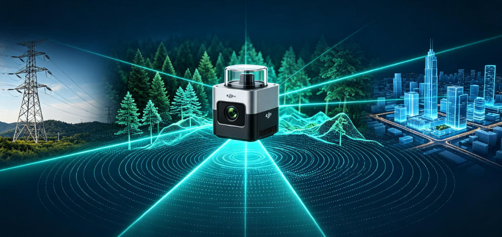
DJI Livox Avia Lidar Applicable to Electric Power, Forestry, Pan-mapping, Smart City Self-driving Robots

6. Conclusion
The combination of DJI Livox Avia LiDAR + TOF technology is driving 3D perception from the 'measurement era' into the 'intelligence era.'
It plays a critical role in:
- Power inspection automation
- Forestry and agricultural digitization
- Smart city 3D modeling
- Autonomous driving and robotics navigation
- High-precision UAV mapping
With advancements in SLAM, AI, and edge computing, TOF LiDAR will become a foundational technology for next-generation spatial intelligence systems.





Please upload banner from store admin blog pages